GIS & Remote Sensing
GSE is the leader of GIS Technology in Palestine and the local Distributer of ESRI.
Photogrammetry
Largest Photogrammetry Labortory in Palestine producing conventional, drone imagery and point cloud.
Training Center
The only Authorized ESRI Learning Center in Palestine with Authorized ESRI Trainers.
About Us
GSE is a registered Consulting Company in Palestine and a member of the Association of Engineers in Palestine and Jordan. Gse is composed of a Team of Professionals in High Tech bringing to its Customers the latest Technology with the Highest standard.
GSE is specialized in GIS Desktop Web and Mobile Mapping, Photogrammetry, Remote Sensing, Aerial Photography and Urban & Town Planning , Road and Survey Engineering.
- Leaders in developing Web Mapping Applications specially for Central and Local Governments and Utilities
- Developing Interactive Maps for Organizations
- Enterprise GIS Systems connecting GIS Data with RDBMS
- ESRI Authorized Learning Center
Mission
The main aim of GSE is the Support and Building Capacities in Palestinian Organization. GSE transfers latest tehnologies supporting, follow-up and building Capacities in its customers organizations.
Learn More


Services
GSE provides services as part of any project. GSE will implement any task using the Professional Staff that are employed by the Company
GIS
Desktop, Web and Mobile GIS customization and Interactive mapping Development.
Provision of GIS Software.
Provision of Content and data.
Web and Cloud Hosting.
Remote Sensing & Imaging
Provision of Software.
Provision of Aerial and Sattelite Imagery and Cloud Points.
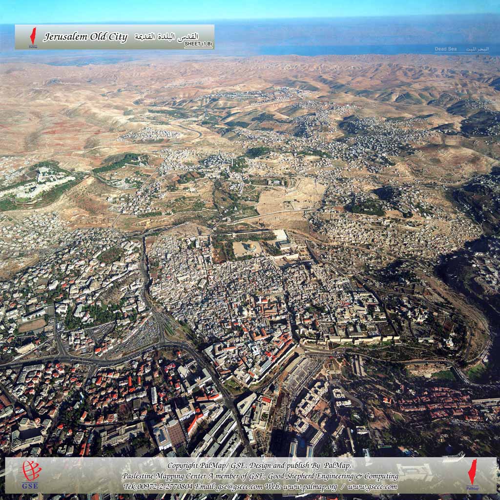
Photogrammetry
Complete production of Aerial imagery in-house, thru aerial photography.
Drone phogrammetry and cloud point production.
Authorized Drone Flying Company.
Engineering Consultations
Road and Survey Engineering, Urban Planning Consultations
GeoLocational Consultations.
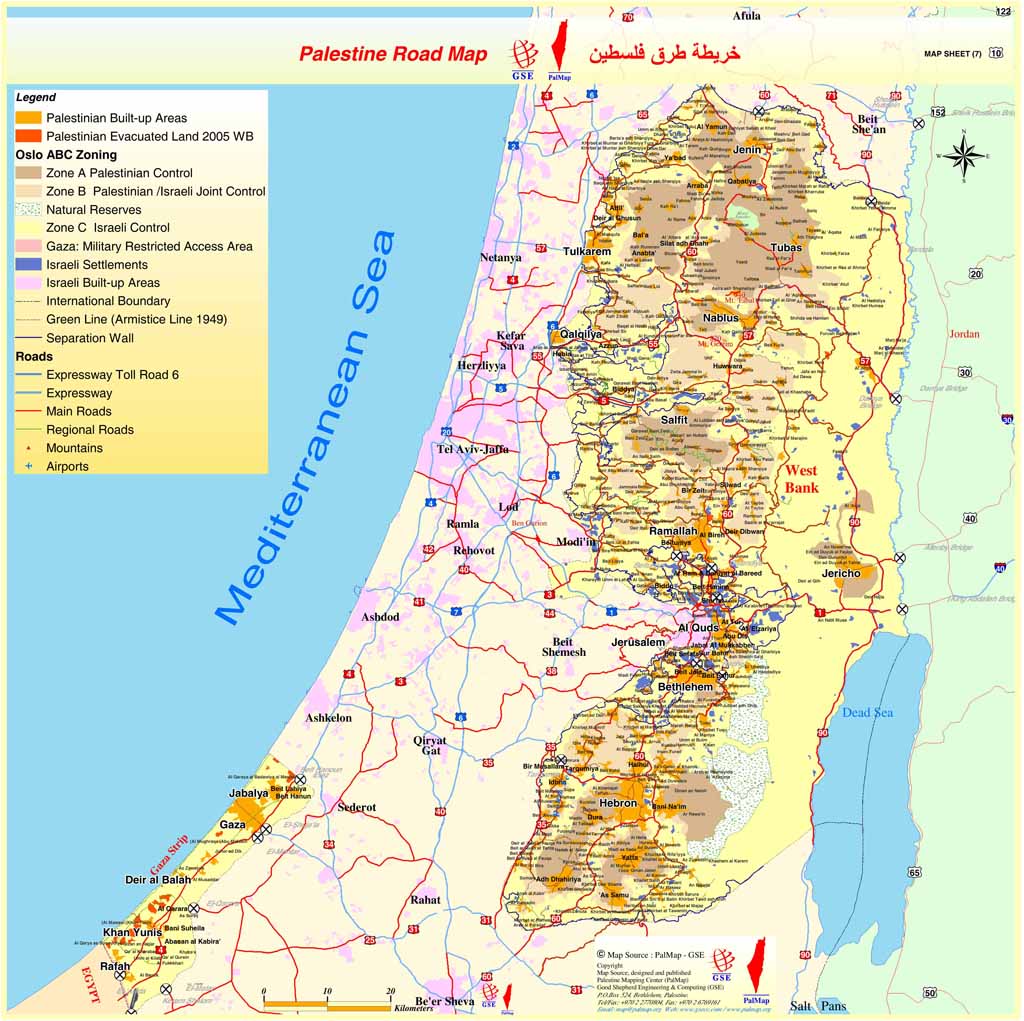
Mapping
Provision of Digital Interactive Mapping
Provision of Press Printed Maps for Tourism, Pilgrims and Historical maps ...
Provision of Mapping Data and Content of Palestine
Palestine Navigation
Provision of Palestine Navigation Data, Digital and hardcopy
iGO Palestine GPS Offline Raod Navigation System.
Provision of Fleet Managemnt Systems and Mapping.
Call To Action
Contact us to schedule an appointment
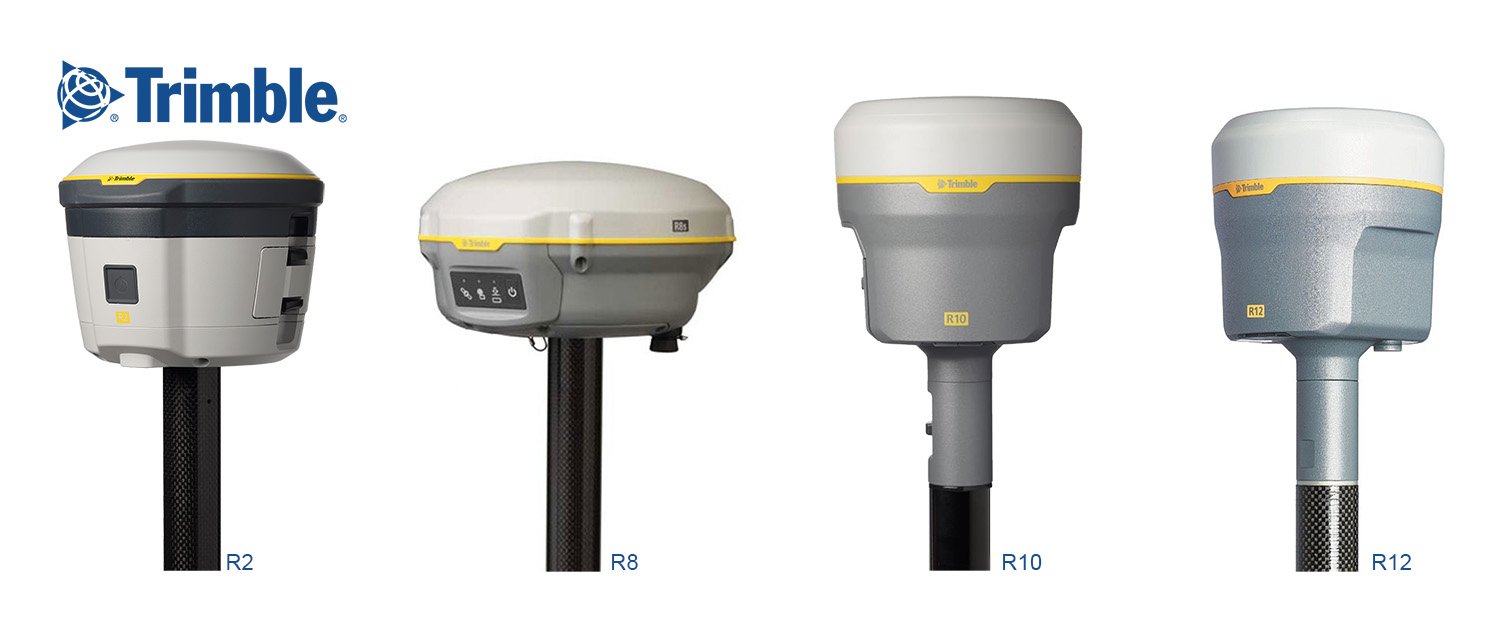
Products
GSE is a partner to International Companies that supply products and Solutions to all its services
- All
- Software
- Hardware
- Maps


Departments
Our Departments are working as One Team to serve our Clients, and make Good Project Satisfaction.

GIS
Hundreds of thousands of organizations in virtually every field are using GIS to make maps that communicate, perform analysis, share information, and solve complex problems around the world. This is changing the way the world works.

Photogrammetry
Photogrammetry is the art, science, and technology of obtaining geometric information on the 3-dimensional shape and orientation of objects from photographs and other imaging sensors.
Remote Sensing & Imaging
Remote sensing is the science of obtaining the physical properties of an area without being there. It allows users to capture, visualize, and analyze objects and features on the Earth’s surface.

Engineering
Engineering is the use of scientific principles to design and build machines, structures, and other items, including bridges, tunnels, roads, vehicles, and buildings.

Data Warehouse
A data warehouse is a type of data management system that is designed to enable and support business intelligence (BI) activities, especially analytics.

IT & Development
Maintaining IT systems and Services, and Building Mapping Applications and custom Widgets for deffirent Client types.
Contact Us
Location:
53 Al-Makhaneq Street, Beit Jala
Email:
info@gse.ps
Call:
+970 2 2744728
Fax:
+970 2 2751204